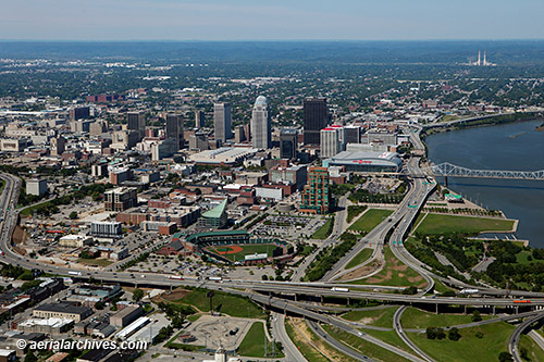
 This aerial photograph of Louisville, Kentucky shows the Louisville Extreme Park and a portion of the East Market district in the foreground together with the interchange of the I-64, I-65 and I-71 freeways. The Riverwalk and the Louisville Slugger Stadium are visible directly behind these features. In the middle ground is the downtown Louisville skyline including the Clark Memorial bridge, the KFC Yum! Center, the PNC Plaza, the AEGON Center and the Louisville International Convention Center. The chimneys of the R. Gallagher Generating Station, a coal burning power plant located on the other side of the Ohio river, in New Albany, Indiana are visible in the background.
Image ID: AHLB9902
© Herb Lingl/aerialarchives.com
More information about aerial photography of Louisville, Kentucky
Gallery of aerial photography of Louisville, Kentucky

