Clear Lake Aviation Gathering | 2023
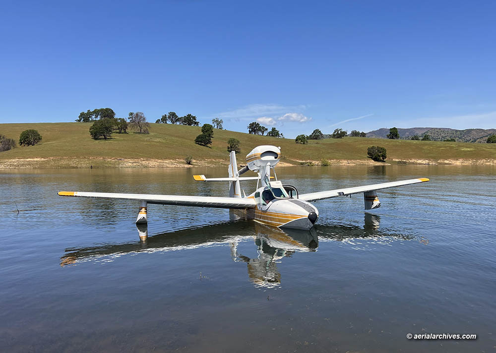
Image ID: AHLC4670
© Herb Lingl/aerialarchives.com
A diverse group of seaplane pilots, aerial photographers and other aviation professionals attended the Clear Lake Aviation Gathering that took place at Lampson Field Airport (1O2) in Lakeport, California on April 22 and 23, 2023.
The Clear Lake Flying Club (CLFC) hosted the conference and produced it with the Professional Aerial Photographers Association (PAPA).
Herb Lingl, education director of the CLFC noted that “One of the conference objectives is to develop opportunities for young people in Lake County, California to pursue careers in aviation.” Details about the youth program are at Clear Lake Flying Club Youth Program.
Conference Sessions
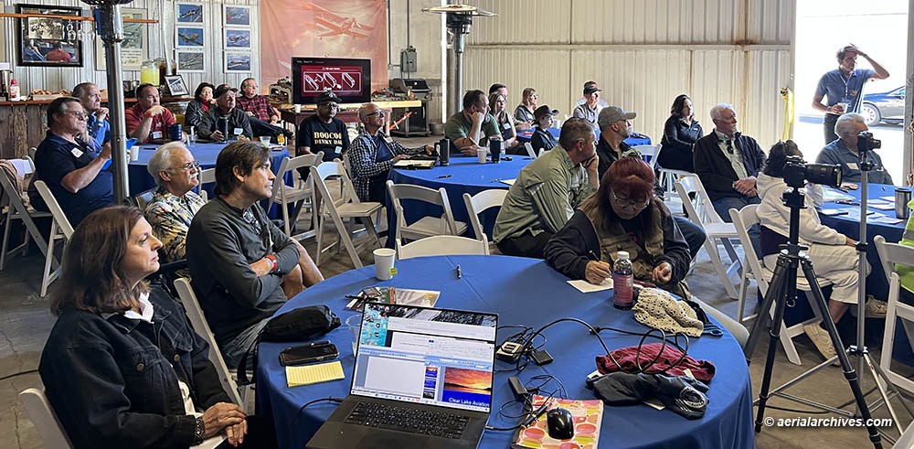
Image ID: AHLC4669
© Herb Lingl/aerialarchives.com
The Aircraft Owners and Pilots Association (AOPA) sent Dr. Stephen Bateman to the conference from Frederick, MD to make presentations about flying clubs and the AOPA Foundation High School STEM Aviation Curriculum which AOPA makes available to high schools at no cost. Details about the curriculum are at AOPA Foundation High School STEM Aviation Curriculum.
Paul Koscheka, the Federal Aviation Administration’s FAASTeam Program Manager at the Sacramento FSDO, provided a briefing on the WINGS Pilot Proficiency Program. Three of the seminars at the conference qualified for WINGS credit.
Additional presenters at the conference included Tom Beattie, instructor and test pilot for ICON Aircraft, Kent Carlomagno, Terry Hayes from Foothill Aviation and the Backcountry Flying Experience, Gordon Mills from Alpine Aviation, Missy Lee, the owner of Alaska Floats and Skis, Herb Lingl, Rick Long, Jason Johanson who provides multi-engine seaplane training in a Twin Seabee and Tom Wasson from Tom’s Aircraft Enterprises.
During the session entitled Which Seaplane Is Right for You?, Tom discussed the ICON A5, Kent the SeaMax, Gordon the Lake Buccaneer, Rick the Quicksilver on floats and Jason the Twin Seabee.
Terry, Gordon, Missy and Jason were the panelists for the Emergency Procedures in Seaplanes session. They discussed emergency procedures as they applied to the specific flying environments in which they operate.
The conference included a session about the History of Aviation in Lake County. Lake County Museums curator J. Clark McAbee prepared a presentation about Navy and Pan Am seaplane operations at Clear Lake entitled Wings Over Water: Flying Boats on Clear Lake circa 1939-1958. Retired high school teachers Miles Turner and John Wiegand described the high school aviation programs they taught at the Lower Lake and Kelseyville High Schools in the 1970s. Paul Loewen, who built a globally recognized Mooney modification firm based at Lampson Field, described the airport’s history from the 1960s, his experience teaching aviation at Mendocino Community College and his experience flying a Fleetwings Sea Bird, a high school aviation project that Paul and his wife Shery flew to Clear Lake with Paul’s high school aviation teacher.
The conference session about the Future of Aviation in Lake County examined plans for the future of aviation in Lake County, including the possible construction of seaplane docks and a seaplane ramp in Lakeport, CA, and a presentation by Dave Dietz of Armstrong Consultants, which specializes in airport engineering, about developing vacant land at Lampson Field for the construction of new hangars.
Seaplane Flight Training on Clear Lake
Gordon Mills from Alpine Aviation provided flight training in the Lake Buccaneer, LA4-200, N6176V, shown at the top of this page to conference attendees who booked flight training before the conference.
Aerial Photography Exhibition
The conference included an aerial photography exhibit and competition. Aerial photographer Amy Hartsfield, PAPA Vice President of Programs, made a presentation about the Professional Aerial Photographers Association and presented information about the aerial photographers whose work was selected to be exhibited at the conference.
Wine Tasting and Catered Hangar Dinner
After the conference sessions, attendees sampled some of the finest wines made in Lake County. These included wines from the Shannon Family of Wines and Lincoln Wines produced by Tom and Ruth Lincoln.
The conference dinner was catered by Lake Event Design, Lake County’s premier event company.
After the dinner, conference attendees voted Jean Luc Kaiser’s aerial photograph of the private Islet of Loreto in northern Italy as their favorite photograph on display. The islet is close to Aero Club Como, one of the oldest seaplane flying clubs in the world. Jean Luc, who owns L’Europe vue du Ciel, a French aerial photography company, received a cash prize for his winning entry.
Raffle Prizes
Raffle winners also received their prizes after the dinner. Donors of raffle prizes benefiting the Clear Lake Flying Club Youth Aviation Program included:
Kent Carlomagno
Mike and Terry Hayes
Tom and Ruth Lincoln and
Herb Lingl
and
Aerial Archives
Aircraft Owners and Pilots Association
Airport Muse
Clear Lake Flying Club
Clear Lake Pilot Supplies
Meadowlark Publishing
Nalas Cleaning Expertise
Professional Aerial Photographers Association and
Tailwheel Ferry Pilot
Fly Out to Lake Berryessa
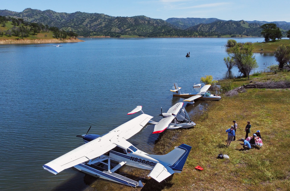
© Byron Hernandez
Image ID: AHLC4668
Sunday featured a seaplane fly out to Lake Berryessa.
The fly out included an ICON A5 flown by Tom Beattie, two Lake Buccaneers, one flown by Gordon Mills the other by Henry Roberson from Air Carriage Inc. and a Cessna 206 on floats flown by Byron Hernandez.
More Information
The full conference program is at Clear Lake Aviation Gathering 2023 Program.
An article that appeared in the magazine Water Flying about the conference is at Water Flying article.
An article that appeared in the magazine In Flight USA about the conference is at In Flight USA article.
An article that appeared in the Lake County Record Bee about the conference is at Record Bee Article-Print and Record Bee Article-Online.
More information about Lampson Field airport is at Lampson Field.
For over forty years, Lake County has hosted the Clear Lake Splash In. This year’s Splash In is scheduled to take place on September 23-24, 2023 in Lakeport. Photographs of previous Clear Lake Splash In events are at photographs of the Clear Lake Splash In.
A selection of aerial photographs of Lake County are at aerial photographs of Lake County.
More information about Lake County, California is at Lake County Visitor Information.