

Aerial Photographs of Denver, Colorado
Aerials Photographs of Denver Available for Immediate License
|
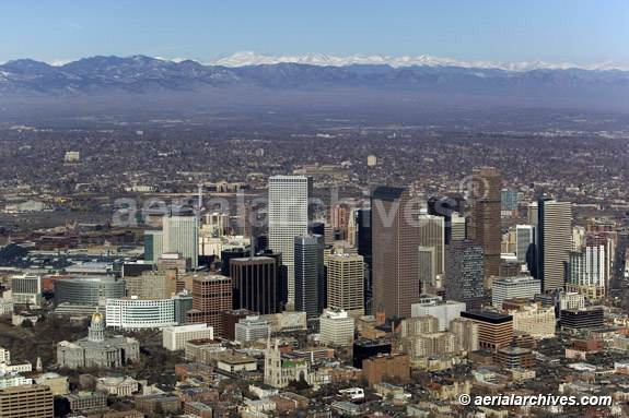
An extensive selection of aerial photographs and aerial maps of Denver, Colorado is represented in the aerial photography library of Aerial Archives. To view aerial photographs of Denver available for immediate online license or prints, please consult Denver aerial photographs. This aerial photography collection includes oblique aerial photographs of Denver, CO, including aerial views of downtown Denver, individual corporate headquarters, the surrounding communities including Golden (including the Coors Brewery and the Colorado School of Mines), Red Rock amphitheater and Broomfield, Colorado. Also available are numerous aerial photographs of the individual buildings in downtown Denver, Colorado. The collection also includes aerial photographs of the major Denver freeways and other Denver urban and geographical features. The archive also contains a comprehensive collection of vertical aerial photographs of Denver and the surrounding area. The aerial photograph of the Denver, Colorado skyline with the Rocky Mountains in the background shown above is available for immediate online license or prints or, to obtain it optimized to your needs please contact Aerial Archives directly and reference the ID number in the caption to the photograph.
|
|
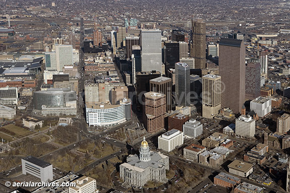
The aerial photograph of downtown Colorado State Capitol and Denver financial district shown above is available for immediate online license or prints or, to obtain it optimized to your needs please contact Aerial Archives
directly and reference the ID number in the caption to the photograph.
|
|
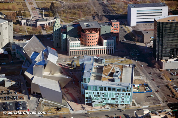
The aerial photograph of the Denver Art Museum and Denver Public Library shown above is available for immediate online license or prints or, to obtain it optimized to your needs please contact Aerial Archives
directly and reference the ID number in the caption to the photograph.
|
|
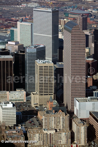
The aerial photograph of the Republic Plaza and Wells Fargo Center office towers in Denver shown above is available for immediate online license or prints or, to obtain it optimized to your needs please contact Aerial Archives
directly and reference the ID number in the caption to the photograph.
|
|
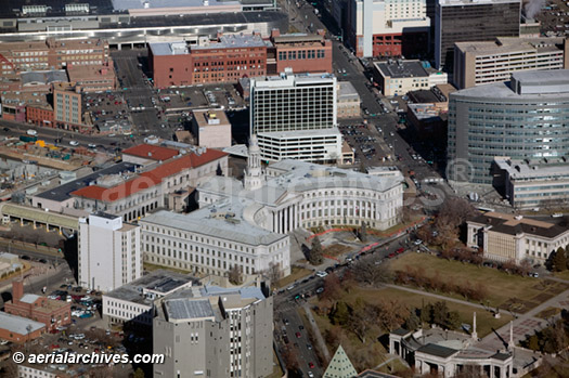
The aerial photograph of the Denver City and County building and City Hall in Denver, Colorado shown above is available for immediate online license or prints or, to obtain it optimized to your needs please contact Aerial Archives
directly and reference the ID number in the caption to the photograph.
|
|
Aerial Archives also delivers aerial maps and satellite photographs of Denver and the rest of Colorado as well as historical aerial maps of Colorado.
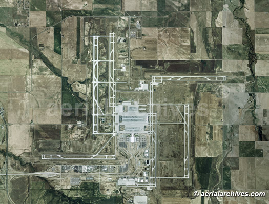
The aerial map of the Denver International airport (KDEN) shown above is available for immediate online license or prints or, to obtain it optimized to your needs please contact Aerial Archives
directly and reference the ID number in the caption to the photograph.
To order a specific aerial photograph of Denver, Colorado not shown on this site or to obtain one of the photographs shown above optimized to your specific specifications, please contact us.
|
|
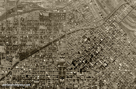
Aerial Archives provides historical aerial photography of Denver and other parts of Colorado. For historical aerial photography we recommend that you use the research request form. Additional information about obtaining existing aerial photography is also available at aerial photography research and at aerial photography research FAQs. The historical aerial photograph of Denver shown above is available for immediate online license or prints or, to obtain it optimized to your needs please contact Aerial Archives directly and reference the ID number in the caption to the photograph. For specific requests for Denver aerial photography not shown on this site, please contact Aerial Archives directly. |