
Recent Aerial Photography Coverage
San Francisco Bay Area, California
Extensive current and historical coverage of the San Francisco Bay Area is available from Aerial Archives. The coverage map below shows the extents of the most recently acquired seamless aerial photography of San Francisco Bay Area which includes complete coverage of Alameda, Contra Costa, Monterey, Napa, San Mateo, Santa Clara and Santa Cruz counties.
|
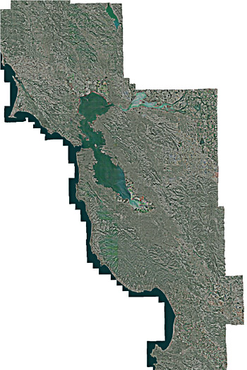
Aerial Coverage Map of San Francisco Region
Acquired May-November, 2008
Extending from northern Sonoma County to southern Monterey County
and eastern Contra Costa County
Image ID: AHLV3001
© Aerials Express
Terms of Image Use | Feedback
|
To obtaining a the complete aerial photography data set for all of the San Francisco Bay Area together with an application that makes creating custom aerial maps easy or to simply obtain a seamless aerial view of a portion of the San Francisco Bay Area, please contact Aerial Archives directly.
|