Month: March 2012

Historical Aerial Photography San Francisco Bay Area

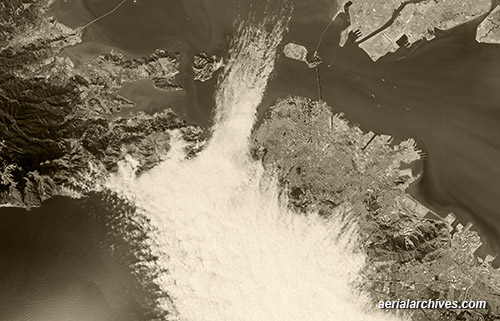
aerial fog moves through Golden Gate into San Francisco Bay
This broad historical aerial overview of San Francisco Bay shows the fog entering through the Golden Gate in 1985. Fog covers a good portion of the City of San Francisco and extends into the bay between Angel Island and Treasure Island. On left side of this aerial photograph are portions of Marin County including Tiburon and the Richmond San Rafael bridge. On the upper right, Alameda and the Port of Oakland. Because the San Francisco Bay Area was an important early center for aviation, it is covered more extensively with historical aerial photography than many other portions of the United States.
Image ID: AHLV3574
© aerialarchives.com

More aerial photography of fog in San Francisco
More aerial photography of San Francisco Bay
More historical aerial photography of California
More San Francisco aerial photography

Share

Aerial Maps and Satellite Imagery of Manhattan New York City

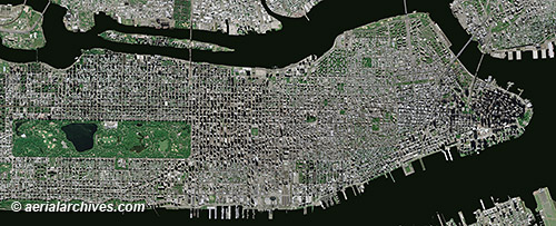
aerial map Manhattan New York City
This aerial map, a mosaic of numerous aerial photographs of New York City, shows Manhattan from the northern end of Central Park to Battery Park. A variety of different straight down, vertical views of Manhattan are available including high resolution satellite imagery, infrared aerial photography and historical aerial photography. Benefits of high resolution satellite imagery include the number of photography acquisition dates that are available and the availability of recent imagery. High resolution satellite imagery of New York City was acquired on over 15 different dates in 2011 and there are already over 3 dates in 2012 for which high resolution satellite imagery of Manhattan is available, the most recent of which was acquired less than 10 days ago.
Image ID: AHLV3491
© aerialarchives.com

More aerial maps of New York City
More about high resolution satellite imagery
Historical aerials of New York City
Search for aerial photography of New York City

Share

Aerial Photography San Andreas Fault Crystal Springs Reservoir

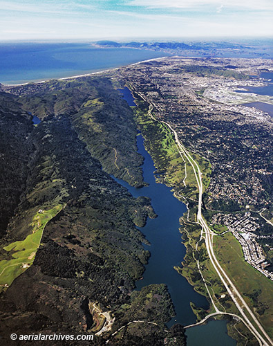
aerial photo San Andreas Fault Crystal Springs Reservoir
A rift valley created by the San Andreas Fault contains the Crystal Springs Reservoir, a pair of artificial lakes in the northern Santa Cruz mountains in San Mateo County, California. The reservoir was built and originally owned by the Spring Valley Water Company and was later deeded to San Francisco. Water is piped into the reservoir from Hetch Hetchy and from the Pilarcitos Creek and Alameda Creek reservoirs. This aerial photograph shows the San Andreas fault as it runs toward Point Reyes. Interstate 280 and the San Francisco International Airport are on the right.
Image ID: AHLB2130
© Herb Lingl/aerialarchives.com

More aerial photography of San Mateo County
Aerial maps of San Mateo county
Share