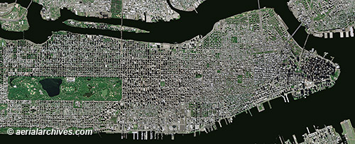
 This aerial map, a mosaic of numerous aerial photographs of New York City, shows Manhattan from the northern end of Central Park to Battery Park. A variety of different straight down, vertical views of Manhattan are available including high resolution satellite imagery, infrared aerial photography and historical aerial photography. Benefits of high resolution satellite imagery include the number of photography acquisition dates that are available and the availability of recent imagery. High resolution satellite imagery of New York City was acquired on over 15 different dates in 2011 and there are already over 3 dates in 2012 for which high resolution satellite imagery of Manhattan is available, the most recent of which was acquired less than 10 days ago.
Image ID: AHLV3491
© aerialarchives.com
More aerial maps of New York City
More about high resolution satellite imagery
Historical aerials of New York City
Search for aerial photography of New York City


Pingback: resistance of a resistor