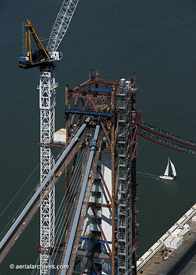
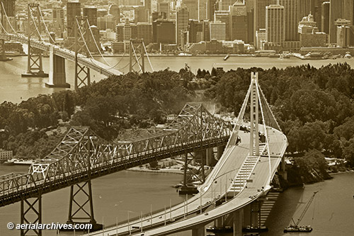
Aerial Photographs of the New Eastern Span of the Bay Bridge August 31, 2013 August 31, 2013 / By Herb Lingl / Aerial Photographs, Aerial Photography Final construction necessary to place the new eastern span of the Bay Bridge into service is underway in this aerial photograph created August 30, which shows the new eastern span tower, the old cantilevered span, and in the left background the western suspension span of the Bay Bridge. Dust is visible at Yerba Buena island where work is taking place to connect the eastern span to the tunnel passing through Yerba Buena. San Francisco's downtown waterfront is visible in the background. Image ID: AHLB9849 © Herb Lingl/aerialarchives.com More aerial photography of the San Francisco Oakland Bay Bridge Information about San Francisco Oakland Bay Bridge aerial photography The latest from Caltrans about the San Francisco Oakland Bay Bridge
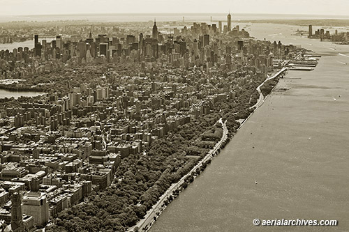
Aerial Photography of Riverside Park Manhattan August 22, 2013 August 22, 2013 / By Herb Lingl / Aerial Photographs, Aerial Photography This aerial photograph of the Manhattan skyline shows Riverside Park, the Hudson River, West Side Drive and the Upper West Side in the foreground. A portion of Central Park and mid town are visible in the background as are One World Trade Center (Freedom Tower), the Empire State building, Brooklyn, Jersey City and the Verrazano-Narrows Bridge. Image ID: AHLB9843 © Herb Lingl/aerialarchives.com Search for aerial photography of New York City More aerial photography of New York City Historical aerials of New York City
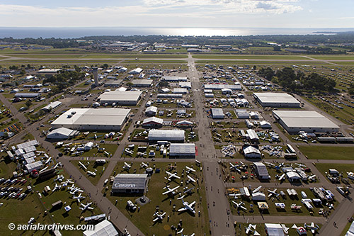
Aerial Photography EAA AirVenture 2013 Oshkosh August 16, 2013 August 17, 2013 / By Herb Lingl / Aerial Photographs, Aerial Photography, Events Aerial Archives created a series of aerial photographs of the Experimental Aircraft Association’s AirVenture 2013 Oshkosh, the largest gathering in the world of aviation enthusiasts on the morning of August 1. This view faces east toward Lake Winnebago and runways 18-36 left and right of the Whittman Regional Airport (KOSH). In the foreground on the right is the display of Cessna Aircraft Company. In the middle ground on the left are the exhibit hangars of Aircraft Spruce & Specialty and Rockwell Collins. In the middle ground on the right are the exhibit hangars of Bendix King by Honeywell and Garmin. Beyond the exhibit hangar of Aircraft Spruce & Specialty toward the runways is the FAA control tower, the busiest control tower in the world during the event. The FAA has staffed a tower at the EAA convention since the 1960s. FAA controllers compete to work the event which is known among controllers as the “Super Bowl” of air traffic control. More than 10,000 airplanes arrive for the event. Many thanks to Don Voland of Aero Optics, Inc and Nick Anderson, the pilot who flew the Bell-47 helicopter from which these aerial photographs were created. Image ID: AHLB9831 © Herb Lingl/aerialarchives.com More aerial photography of AirVenture 2013, Oshkosh, Wisconsin Aerial photography of Oshkosh, Wisconsin More information about the Experimental Aircraft Association and AirVenture
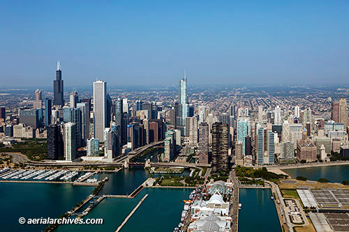
Aerial Photography Chicago January 10, 2013 June 22, 2013 / By Herb Lingl / Aerial Photographs, Aerial Photography This aerial photograph of the Chicago skyline from Lake Michigan shows the Navy Pier in the foreground, the Willis Tower and a portion of Millenium Park on the left and the Chicago river and Trump Tower toward the center of the photograph. Image ID: AHLB9385 © Herb Lingl/aerialarchives.com More aerial photography of Chicago, Illinois More information about aerial photography of Chicago, Illinois
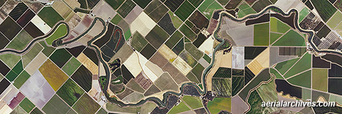
Aerial Archives Murals on Display at East Bay Regional Park District’s Big Break Visitor Center July 11, 2012 June 22, 2013 / By Herb Lingl / Aerial Photographs, Aerial Photography Two large aerial photography murals of the Sacramento River Delta are part of a new exhibit at the Big Break Visitor Center in Oakley, California. The exhibit, designed by Nick Cavagnaro and Doyle Wegner of the East Bay Regional Park District with assistance of Frank Binney and Associates, provides insight into the Delta’s geography, history and uses. Three fourths of Delta lands are used for agricultural purposes as illustrated in this aerial photograph. Because of the Delta’s fertile peat soils and controlled marine influence, it produces a yield per acre that is almost 50% higher than California’s average. Image ID: AHLV3553 © aerialarchives.com More aerial photography of the Sacramento San Joaquin river delta More information about aerial photography of the Delta More information about the East Bay Regional Park District’s Big Break Regional Shoreline
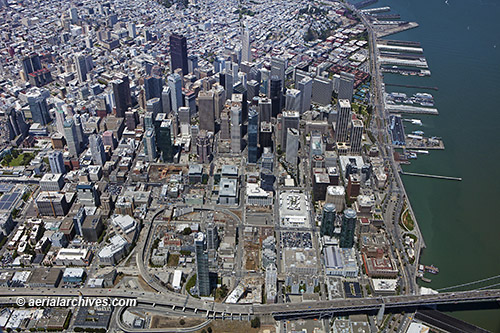
Aerial Photography Transbay Transformation San Francisco June 4, 2012 June 22, 2013 / By Herb Lingl / Aerial Photographs, Aerial Photography, Construction Numerous construction sites around the Transbay Center development site and its proximity to the SoMa district in San Francisco promise to transform a portion of the city and its skyline in the next several years. This aerial photograph shows the One Rincon Hill tower and the western ramps of the Bay Bridge in the foreground, the Transbay Terminal Center construction site toward the center, the San Francisco financial district behind it and the amount of space still available for development in this part of the city. Image ID: AHLB9288 © Herb Lingl/aerialarchives.com More aerial photography of the Transbay Center and vicinity More information about the Transbay Transit Center More information about aerial photography of San Francisco More aerial photography of San Francisco architecture
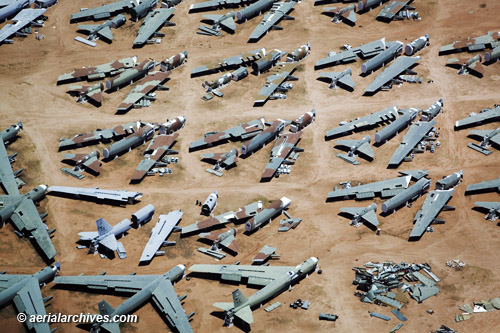
Aerial Photography Davis-Monthan aircraft boneyard May 24, 2012 June 22, 2013 / By Herb Lingl / Aerial Photographs, Aerial Photography This aerial photograph of the aircraft boneyard at the Davis-Monthan Air Force Base shows a number of disassembled Boeing B-52 Stratofortresses. Image ID: AHLB3543 © Herb Lingl/aerialarchives.com More aerial photography of the Davis Monthan aircraft boneyard Prints and licenses of Davis Monthan boneyard aerials Print discount coupons
Aerial Photography San Francisco Oakland Bay Bridge Construction May 14, 2012 June 25, 2013 / By Herb Lingl / Aerial Photographs, Aerial Photography, Construction This aerial photograph shows work on the 525 foot self-anchored suspension span support tower for the replacement of the eastern span of the San Francisco Oakland Bay bridge. Image ID: AHLB9161 © Herb Lingl/aerialarchives.com More aerial photography of the San Francisco Oakland bay bridge
Aerial Photography Compilation San Francisco Bay Area May 9, 2012 June 22, 2013 / By Herb Lingl / Aerial Photographs, Aerial Photography, Video A compilation of still aerial photography of the San Francisco Bay Area including sailing on the bay, San Francisco, headquarters of Apple, Facebook and Google, Stanford University and Hangar One at Moffett Field. Music by John Ming Video ID: AHLM2018 © Herb Lingl/aerialarchives.com More aerial photography of San Francisco More aerial photography of San Francisco bay More music by John Ming, aka John Poot
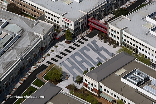
Aerial Photography of Facebook Headquarters, 1 Hacker Way, Menlo Park May 7, 2012 June 23, 2013 / By Herb Lingl / Aerial Photographs, Aerial Photography Aerial photograph of Facebook headquarters in Menlo Park. Image ID: AHLB9169 © Herb Lingl/aerialarchives.com More aerial photography of Menlo Park More aerial photography of Silicon Valley