Satellite Imagery

Aerial Photo Maps of San Francisco
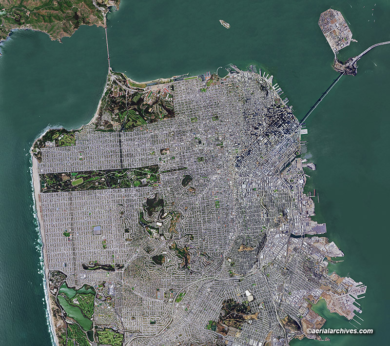
aerial photo map of San Francisco, California, 2020
Image ID: AHLV4666

Aerial Archives provides current and historical aerial photo maps of San Francisco, California.

The aerial photograph shown above is a composite of many aerial photos and is suitable for enlargement to 14′ wide.

Higher resolution imagery which will enlarge to 30′ wide of the same view is also available on a custom basis.

In addition to aerial photography, Aerial Archives provides very recent satellite imagery of San Francisco.

License this photograph or purchase a print

More information about aerial photo maps of San Francisco

Aerial maps of San Francisco available for immediate license or prints

Share

San Francisco Bay Area High Resolution Aerial Photography and Satellite Imagery

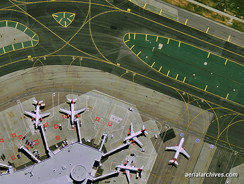
Virgin America Terminal at SFO
This aerial photograph showing the Virgin America terminal at the San Francisco International Airport ("SFO") is part of a high resolution aerial photography data set that covers the entire San Francisco Bay Area acquired in 2011. The imagery has a resolution of a 1' pixel -- one pixel or picture element covers one foot on the ground. The imagery is suitable for printing up to an approximate scale of 1"=100'. Included in the coverage of this data set are the following Bay Area counties: San Francisco, Alameda, Contra Costa, San Mateo, Santa Clara, Sonoma and Napa. High resolution satellite imagery is acquired even more frequently. The most recent acquisition of San Francisco has a 50cm pixel resolution and was acquired yesterday, April 19, 2012. Additional recent high resolution satellite imagery of the San Francisco bay area was acquired
April 8 and April 4, 2012.
Image ID: AHLV3608

More information about high resolution satellite imagery
Aerial maps of San Francisco
More information about aerial maps

Share

Aerial Maps and Satellite Imagery of Manhattan New York City

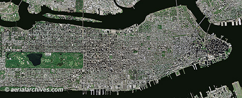
aerial map Manhattan New York City
This aerial map, a mosaic of numerous aerial photographs of New York City, shows Manhattan from the northern end of Central Park to Battery Park. A variety of different straight down, vertical views of Manhattan are available including high resolution satellite imagery, infrared aerial photography and historical aerial photography. Benefits of high resolution satellite imagery include the number of photography acquisition dates that are available and the availability of recent imagery. High resolution satellite imagery of New York City was acquired on over 15 different dates in 2011 and there are already over 3 dates in 2012 for which high resolution satellite imagery of Manhattan is available, the most recent of which was acquired less than 10 days ago.
Image ID: AHLV3491
© aerialarchives.com

More aerial maps of New York City
More about high resolution satellite imagery
Historical aerials of New York City
Search for aerial photography of New York City

Share

High Resolution Satellite Imagery of China

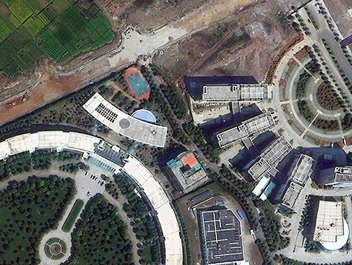
Satellite Imagery Ningbo China
This high resolution satellite image documents the edge of development in Ningbo, one of China's oldest cities. While it has an ancient history, Ningbo's economy is growing rapidly. High resolution satellite imagery is proving to be an exceptionally useful tool in China, because of its vast size, the rapid changes taking place and the more limited availability of airborne imaging. Atmospheric visibility issues can further stretch out the time frames for projects relying on acquiring new imagery. That's why an archive of existing, high resolution, cloud free, recent satellite imagery of China can be invaluable. Aerial Archives provides its US clients access to DigitalGlobe's large archive of high resolution satellite imagery of China which includes recent imagery of over 150 of China's largest cities.
Ningbo, Zhejiang, China
Image ID: AHLS2010

More about high resolution satellite imagery of China

Share