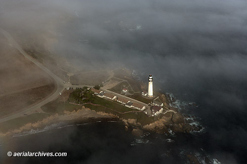
Aerial Photography San Jose California April 10, 2012 June 24, 2013 / By Herb Lingl / Aerial Photographs, Aerial Photography This aerial photograph of downtown San Jose, California shows San Jose City Hall, designed by Richard Meier & Partners and numerous additional buildings in the vicinity, including the Knight Ridder building, the Cathedral Basilica of St. Joseph, the Fairmont San Jose hotel and portions of San Jose State University. San Jose is the tenth largest city in the USA and third largest in California. It is the headquarters of numerous companies including Adobe Systems, Cisco Systems and eBay. Image ID: AHLB5718 © Herb Lingl/aerialarchives.com More information about San Jose, California aerial photography View aerial photography of San Jose Aerial photography of Silicon Valley
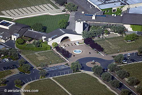
Aerial Photography of the Robert Mondavi Winery April 3, 2012 June 22, 2013 / By Herb Lingl / Aerial Photographs, Aerial Photography This aerial photograph shows the Robert Mondavi Winery at its current location in the Napa Valley between Oakville and Rutherford. Robert Mondavi founded the winery in 1966 with the objective of producing quality wines that would rival their European counterparts. He became a pioneer in developing and marketing California wines. Constellation Brands, Inc., the world's largest wine company, acquired Robert Mondavi Winery in 2004. Image ID: AHLB4615 © Herb Lingl/aerialarchives.com More information about Napa Valley aerial photography View aerial photography of Napa Valley Aerial Maps and Satellite Imagery of Napa Valley Aerial Photography of California Wine Growing Regions
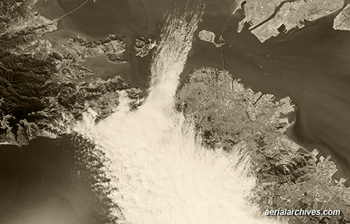
Historical Aerial Photography San Francisco Bay Area March 28, 2012 June 22, 2013 / By Herb Lingl / Aerial Photographs, Aerial Photography, Historical Aerial Photography This broad historical aerial overview of San Francisco Bay shows the fog entering through the Golden Gate in 1985. Fog covers a good portion of the City of San Francisco and extends into the bay between Angel Island and Treasure Island. On left side of this aerial photograph are portions of Marin County including Tiburon and the Richmond San Rafael bridge. On the upper right, Alameda and the Port of Oakland. Because the San Francisco Bay Area was an important early center for aviation, it is covered more extensively with historical aerial photography than many other portions of the United States. Image ID: AHLV3574 © aerialarchives.com More aerial photography of fog in San Francisco More aerial photography of San Francisco Bay More historical aerial photography of California More San Francisco aerial photography
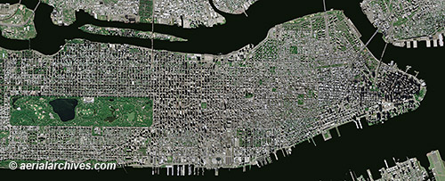
Aerial Maps and Satellite Imagery of Manhattan New York City March 21, 2012 June 23, 2013 / By Herb Lingl / Aerial Photographs, Aerial Photography, Historical Aerial Photography, Satellite Imagery This aerial map, a mosaic of numerous aerial photographs of New York City, shows Manhattan from the northern end of Central Park to Battery Park. A variety of different straight down, vertical views of Manhattan are available including high resolution satellite imagery, infrared aerial photography and historical aerial photography. Benefits of high resolution satellite imagery include the number of photography acquisition dates that are available and the availability of recent imagery. High resolution satellite imagery of New York City was acquired on over 15 different dates in 2011 and there are already over 3 dates in 2012 for which high resolution satellite imagery of Manhattan is available, the most recent of which was acquired less than 10 days ago. Image ID: AHLV3491 © aerialarchives.com More aerial maps of New York City More about high resolution satellite imagery Historical aerials of New York City Search for aerial photography of New York City
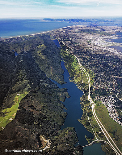
Aerial Photography San Andreas Fault Crystal Springs Reservoir March 16, 2012 June 22, 2013 / By Herb Lingl / Aerial Photographs, Aerial Photography A rift valley created by the San Andreas Fault contains the Crystal Springs Reservoir, a pair of artificial lakes in the northern Santa Cruz mountains in San Mateo County, California. The reservoir was built and originally owned by the Spring Valley Water Company and was later deeded to San Francisco. Water is piped into the reservoir from Hetch Hetchy and from the Pilarcitos Creek and Alameda Creek reservoirs. This aerial photograph shows the San Andreas fault as it runs toward Point Reyes. Interstate 280 and the San Francisco International Airport are on the right. Image ID: AHLB2130 © Herb Lingl/aerialarchives.com More aerial photography of San Mateo County Aerial maps of San Mateo county
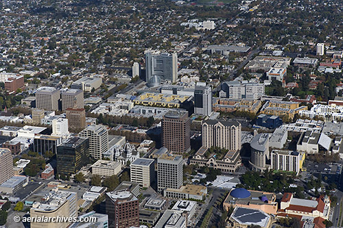
Aerial Photography Pigeon Point Lighthouse February 28, 2012 June 22, 2013 / By Herb Lingl / Aerial Photographs, Aerial Photography Originally lit at sunset November 15, 1872, the Pigeon Point Lighthouse has a Fresnel lens which is composed of over 1000 prisms and lenses. The lighthouse and the rocky promontory on which it sits are visible through the fog in this aerial photograph and are preserved as Pigeon Point Light Station State Historic Park, a California state park. Located on highway one 5 miles south of Pescadero, it is an important landmark for ships approaching San Francisco from the south. The lighthouse was originally equipped with a lamp that burned refined lard, which was later replaced by a kerosene lamp and in 1926 by a 1000 watt electrical bulb. The Fresnel lens has a range of 24 nautical miles and is now lit only on special occasions though a rotating 24 inch aerobeacon mounted on the front of the tower is still an active navigation aid. An electrically operated fog horn has also been installed. Image ID: AHLB8220 © Herb Lingl/aerialarchives.com More aerial photography of San Mateo County Aerial maps of San Mateo county
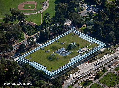
Aerial Photograph of the Green Roof at the San Francisco Academy of Sciences February 1, 2012 July 22, 2013 / By Herb Lingl / Aerial Photographs, Aerial Photography Designed by Renzo Piano, the California Academy of Sciences living roof covers an area of 197,000 square feet. This aerial photograph of the green roof shows the undulations which are part of the design and draw cool air into the open piazza located in the center of the building. Green roofs are excellent insulators reducing both heating and cooling energy consumption. The roof helps to lower urban air temperature, mitigating the heat island effect, causing cities to be significantly warmer than the surrounding areas. The nine species of native plants growing on the roof were selected for their ability to thrive and propagate in the unique climate present in Golden Gate park. Among the species are wildflowers including the California poppy and the California plantain and a variety of perennial plants. Image ID: AHLB8220 © Herb Lingl/aerialarchives.com More aerial photography of San Francisco More aerial photography of Golden Gate Park
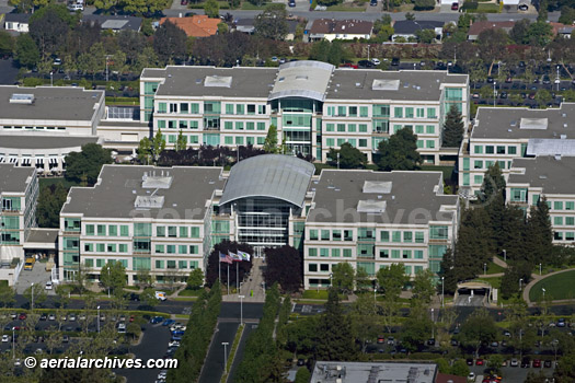
Aerial Photography of Apple Silicon Valley Campus January 25, 2012 June 22, 2013 / By Herb Lingl / Aerial Photographs, Aerial Photography An aerial photograph of Apple Inc.'s world corporate headquarters located at 1-6 Infinite Loop, Cupertino, California. This campus occupies 32 acres located in the heart of Silicon Valley at the southeastern corner of Interstate 280 and De Anza Boulevard. Built in 1993 by Sobrato Development Cos, the Apple campus consists of six buildings that total 850,000 square feet. Image ID: AHLB4633 © Herb Lingl/aerialarchives.com More aerial photography of Silicon Valley More aerial photography of Cupertino
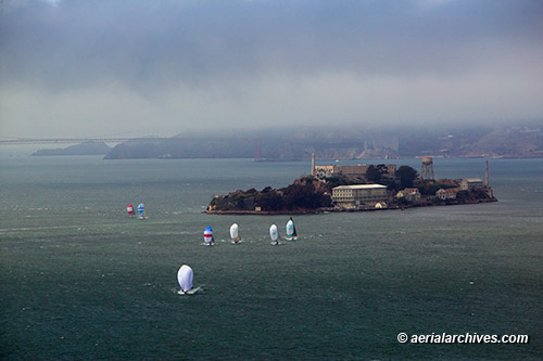
Aerial Photography San Francisco Bay Rolex Big Boat Series January 9, 2012 June 22, 2013 / By Herb Lingl / Aerial Photographs, Aerial Photography, Events Contestants in the 2011 the Rolex Big Boat Series sailboat regatta in San Francisco Bay sail downwind under a blanket of fog in this aerial photograph with Alcatraz and the Golden Gate bridge in the background. St. Francis Yacht Club created the series 47 years ago to showcase big boat yachting talent, and each year the regatta attracts many world caliber sailors. San Francisco Bay is one of the premier sailing venues in the world. San Francisco has been selected to host the next America's cup, sailing's premier regatta in 2013. Image ID: AHLB8853 © Herb Lingl/aerialarchives.com More aerial photography of San Francisco bay More aerial photography of San Francisco
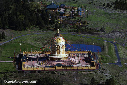
Aerial Photography Odiyan Buddhist Retreat Center, Sonoma County, California December 21, 2011 June 22, 2013 / By Herb Lingl / Aerial Photographs, Aerial Photography The Odiyan Buddhist Retreat Center consists of over 1000 acres in northwestern Sonoma County, California. It was founded by Tarthang Rinpoche, who was born in northeastern Tibet. The Odiyan center has planted over 250,000 trees on the once heavily logged property. A pilgrimage trail across the land owned by the Odiyan Buddhist Retreat Center is marked by 108 stupas. The structure shown in this aerial photograph is the bronze Cintamani Temple, which was completed in 2008 and stands 140 tall. It contains sculptures of Buddhas and Bodisattvas which range from 12 to 35 feet tall. A community of 40-50 lay people ranging from 22 to 75 years old reside at the Odiyan Buddhist Retreat Center. Image ID: AHLB7979 © Herb Lingl/aerialarchives.com More details about aerial photography of Sonoma County More aerial photography of Sonoma County