
|
Evaluating the scale and resolution of aerial photography enables you to determine the amount of detail you can expect from an aerial photograph. The resolution of aerial photography acquired on film is expressed by a film scale. Film scale is usually expressed either as a ratio (e.g. 1:12,000) indicating that a unit of distance on the film will show identical units of distance on the ground or as a feet per inches (e.g. 1"=1000') scale. 1:12,000 and 1"=1000' express the same film scale. The resolution of aerial photography acquired digitally is usually expressed as a distance on the ground represented by each pixel. For example, in the case of aerial photography 6" pixel resolution aerial photography, each pixel covers 6" on the ground.
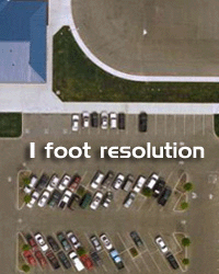
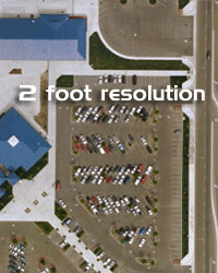
Digital Acquisitions The following examples illustrate the level of detail one can expect with different digital resolutions of aerial photography.
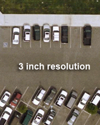
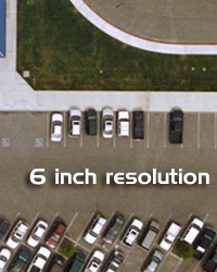
6" pixel resolution is suitable to enlarge 50' on the ground to 1" on a print 1' pixel resolution is suitable to enlarge 100' on the ground to 1" on a print 2' pixel resolution is suitable to enlarge 200' on the ground to 1" on a print For example, aerial photography with a 6" pixel resolution covering a distance of 1000' on the ground is suitable for creating a print up to 20" showing the 1000' distance.
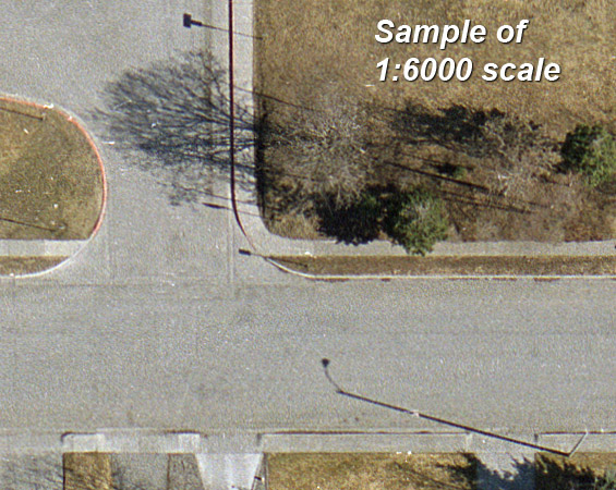
The following examples illustrate the level of detail that the viewer can expect to resolve with different film scales of aerial photography. The scales are expressed in a ratio. To arrive at a comparable inches to feet expression of the same scale, divide the second number by 12, e.g. 1:6000 is identical to 1"=500. When evaluating the level of detail one can obtain from dufferent scales of film aerial photography it is important to verify that the scale is an expression of film scale. A print that has a similar scale will show significantly less detail. More information about film scales in aerial photography and the different ways of expressing them is available at high resolution aerial photography.
1:6,000 Aerial Photography Film Scale with Color Aerial Film Stock An aerial photography film scale of 1:6,000 will not be available for most sites. However, when it is available the amount of information that can be obtained from this imagery is extensive, particularly if flown in stereo. The early morning light on this imagery provides additional opportunities for photo interpretation because of the detailed shadows.
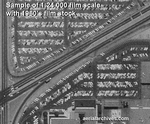
1:24,000 Aerial Photography Film Scale with 1960's Aerial Film Stock Common film scales for earlier aerial photography are 1:24,000 (or the slighly better 1:20,000). One issue to keep in mind when considering whether a scale will be suitable is that some older film stock may show slightly less detail than newer film stock. Additional variations in amount of detail may be caused by the lens used and the exposure settings used to acquire a photograph.
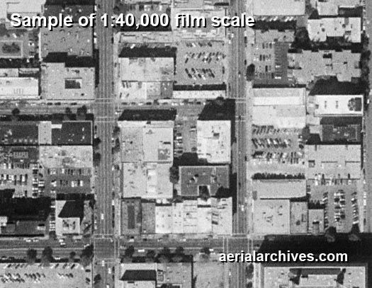
1:40,000 Aerial Photography Film Scale
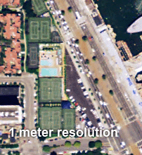
Additional scale and resolution samples are available on request by contacting Aerial Archives. For recent years, high resolution satellite imagery can provide an additional source of imagery because of the more frequent acquisitions. Satellite imagery resolution is usually also expressed in a distance covered per pixel. For addition details about the resolution of satellite imagery please visit high resolution satellite imagery. Althought satellite imagery dates back to the 1960s. Early satellite imagery has a very broad resolution scale, but imagery acquired in the last 5 years has a resolution that equals or even surpasses some aircraft acquired aerial photography. If you have specific questions concerning resolution not covered on this page, please contact Aerial Archives directly. |